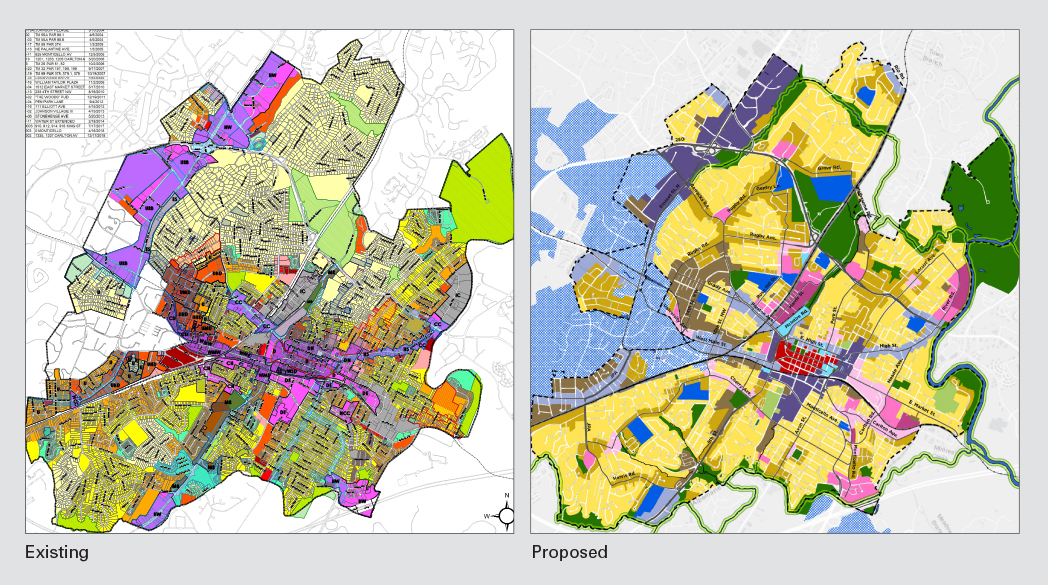
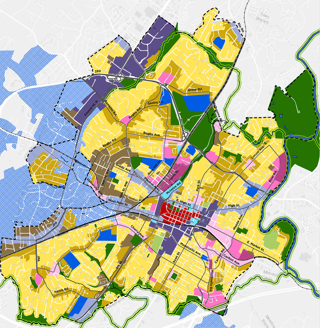
The latest version of the Future Land Use Map, a much-debated document that will guide Charlottesville’s development as the city begins to rewrite its zoning code, is out for review. The map is intended to steer Charlottesville toward a future with more affordable places to live.
“We believe this draft continues to support the goal of increasing housing options and affordability throughout the city, by supporting multifamily residential at a variety of scales, on all residential parcels,” said Jennifer Koch of the firm Rhodeside & Harwell (RHI).
Others aren’t so sure, including at least one member of the Planning Commission.
“We were promised a process that would be intentional about centering the voices of those who haven’t historically been considered in land use decision making,” said Rory Stolzenberg in a comment on Twitter this past Sunday. “Now it appears that [Cville Plans Together] is specifically prioritizing our wealthiest landowners.”
In late 2019, the city hired RHI to restart a review of the city’s Comprehensive Plan. The first step of that process was to enact an affordable housing plan, which City Council did in March. One high-level priority in the plan is “to address the legacy of exclusionary zoning and constrained housing supply in Charlottesville.”
In order to meet that goal, RHI drafted a land use map, showing where zoning could change in the city to allow more density. In late March, the Planning Commission saw the first version of the map, and a majority of commissioners asked for higher by-right density across the city, particularly in neighborhoods that are currently predominated by single family homes.
RHI took those comments into consideration and released a second map in late April. At that point, some residents of singe-family neighborhoods expressed concerns that their land was being designated for “medium-intensity residential” with as many as 12 units allowed per lot. Several “neighborhood mixed-use nodes,” spots where commercial buildings could be added to residential neighborhoods, were spread around the city, which also drew the ire of some homeowners.

A group called Citizens for Responsible Planning formed to oppose the changes. At the same time, the Charlottesville Low-Income Housing Coalition led a campaign to push for higher densities.
The latest map scales back many of the more ambitious proposals in from the April version. In the April map, the Lewis Mountain neighborhood had been designated as medium-intensity. In the newest iteration, that has mostly changed back to general residential. Similar scope reductions were made in the Barracks/Rugby and North Downtown neighborhoods.
The text definition for “general residential” has changed as well, reducing theoretical building height from 3.5 stories to 2.5. However, four units would be allowed on each lot if the fourth one was kept below market value. The first two maps limited that to three.
A person speaking for Citizens for Responsible Planning said in an email that the latest version is an improvement over the May version. The spokesperson did not want to be identified, but the group’s physical address is the law firm Flora Pettit.
“We are happy to see some of the more obviously inappropriate Mixed-Use Nodes have been nixed, a few Medium Intensity Residential zones have been pared back, emphasis on actual affordable housing production has been increased, and verbiage has been added to suggest multifamily buildings should be ‘house-sized,’ consider the context of surrounding neighborhoods and respect more reasonable height limits,” reads the email.
Another group, Livable Cville, has formed to advocate for increased density across the city. Its letter to the Planning Commission asks for the restoration of the second map so that more triplexes and quadplexes can be built across the city.
“It appears the revised [map] you are considering this week will likely significantly limit Charlottesville’s ability to meet its goal of providing additional multifamily housing without furthering displacement,” reads the letter. “In some cases, the latest draft makes it harder to build new homes than the status quo.”
Other changes in the map reflect rezoning applications that are making their way through the process. Piedmont Housing Alliance is seeking to build 145 units on a section of Park Street, north of the U.S. 250 bypass. That land is currently designated as low-intensity residential but the new map has increased that to “high-intensity residential.”
The latest draft also includes a proposed overlay for “sensitive communities” in areas with households believed to be prone to displacement. The city’s Housing Advisory Committee argues that the new plan should limit new high-density developments in communities like 10th and Page and Fifeville.
“Retaining existing homes and residents, and supporting homeownership and generational wealth-building, is important throughout the city, but there are sensitive areas that may require additional affordability requirements, incentives, or other tools to support these goals,” reads a portion of RHI’s presentation to the Planning Commission.
The Planning Commission discussed the land use map at a meeting on Tuesday night that took place too late for this edition. Cville Plans Together will host a public steering committee meeting over Zoom on Wednesday, September 1. Watch this space for updates on the Comprehensive Plan process in the coming weeks.


